• Log In
  • Register
  • 2022
Site logo
Sticky header logo
Site logo
  • HOME
  • ABOUT US
    • EUSDR PA5 Targets
    • Financing PA 5 activities
      • DRP-PAC-PA5
      • DTP-PAC-PA5
      • DTP-PAC2-PA5
    • Steering Group
      • Steering Group Members
    • Disaster Management Working Group
  • NEWS
    • 2025
    • 2024
    • 2023
    • 2022
    • 2021
    • 2020
    • 2019
    • 2018
    • 2017
    • 2016
    • 2015
    • 2014
    • 2012
  • EVENTS
    • PHOTOS
  • PROJECTS
    • PA5 Letter of Recommendation (LoR)
    • Accidental pollution
      • SAFETY4TMF
      • REVITAL I
    • Climate change
      • CARPWET
      • LIFE-MICACC
      • LIFE LOGOS 4 WATERS
    • Disaster Management
      • STOPFIRES
      • MYRIAD
      • DARENET
      • RISKHUB II.
      • DiMaND
      • PROFOUND
      • PREP-R
      • RISKHUB
      • SEERISK
      • WACOM
      • Wildfire
      • HTU
    • Drought
      • DriDanube
      • WATERatRISK
    • Early warning
      • MONITOR II
      • DAREFFORT
      • EAST AVERT
      • ForMURA
      • RaabFlood4cast
      • E-FLOOD platform
    • Flood management
      • CAMARO-D
      • InterFloodCourse
      • FloodUZH
      • JOINTISZA
      • SAFETISZA
      • LIFE SandBoil
      • DELOGFLOOD
      • O+D
      • DANUBE FLOODRISK
      • PLATFORM
    • Floodplain management
      • Lower Morava Floodplains
      • Danube Floodplain
      • Danube Sediment
      • SEDDON-II
      • Morchflood
    • DTP Thematic Pole – Water Management
    • GWP – IDMP CEE
  • DOCUMENTS
    • Steering Group Meetings
    • Events
    • Publications
    • Progress of PA5 Actions
    • Other documents
  • E-LEARNING
    • PA5 E-learning material
    • DANUBE FLOODPLAIN online course
    • DAREFFORT e-learning
  • CONTACT US
  • Submission Confirmed
  • Browse Submissions
  • Document Library
PrevApproaching the demonstration period of the TAMIR project17 June 2021NextSpecial Report on Drought 202129 June 2021

ForMURA project kick-off meeting


The online opening conference of the

ForMURA project

was organized by the Croatian partner Hrvatske Vode with the cooperation of the

West-transdanubian Water Directorate

on 24 June 2021.

The scope of the ForMURA (Upgrade and development of flood alarm and forecast model of MURA) project is the flood plain and foreshore of the river Mura that is the 48 km long section of Hungarian and Croatian common interest of the River Mura. Flood effects and risks along this section inseparably affect both areas and thus trigger a need for close cooperation in protection activities. Austria, Slovenia, Croatia, and Hungary developed the international flood alarm and forecasting system in 2011 for the whole catchment area of the Mura.


The ForMura project received a Letter of Merit from the EU Strategy for the Danube Region Environmental Risks priority area since it is connecting to one of the actions of the priority area (“To strengthen operational cooperation among the emergency response authorities in the Danube countries and to improve the interoperability of the available assets”)


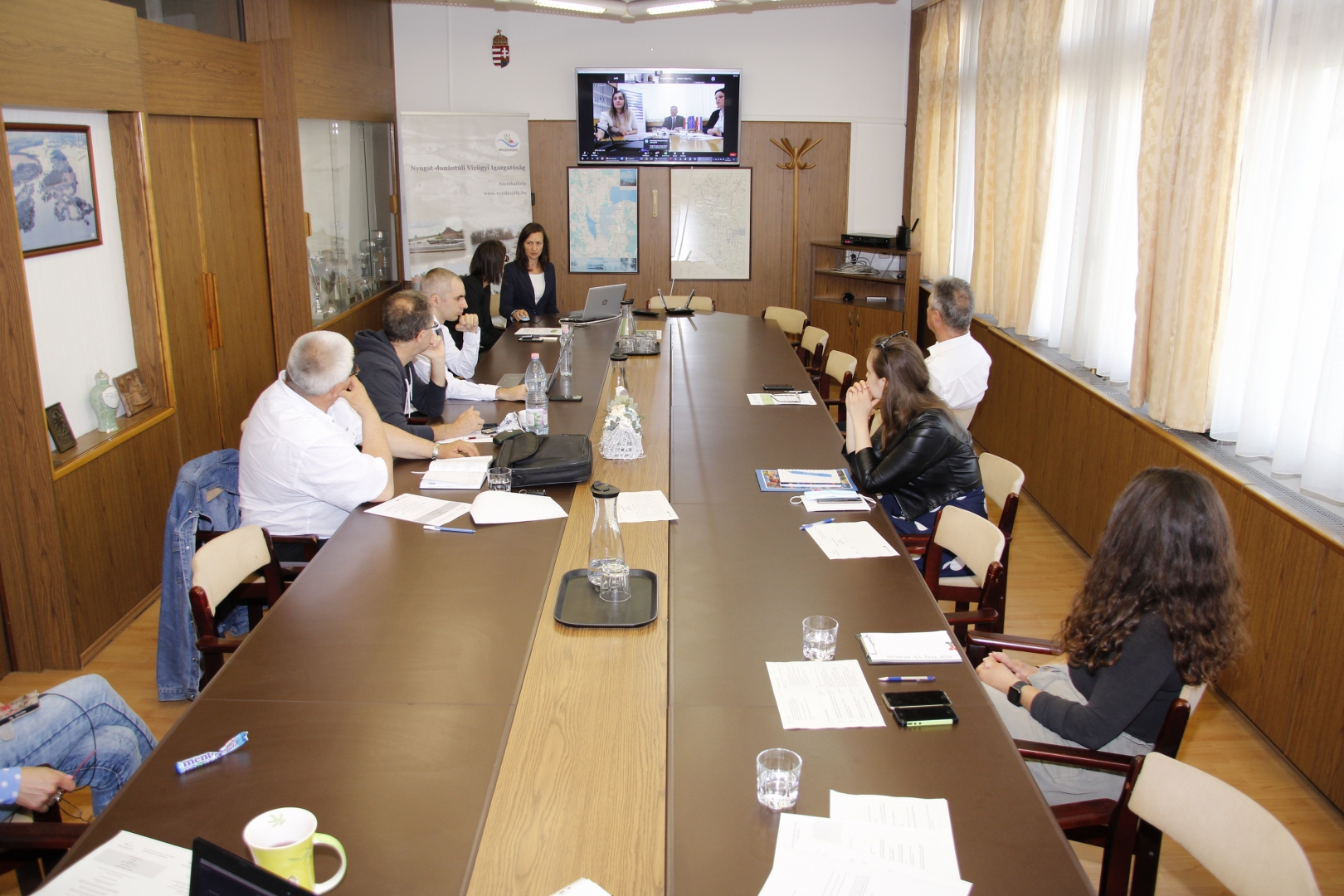
The ForMURA project is being implemented within the framework of the Interreg V-A Hungary-Croatia Co-operation Programme 2014-2020. The event was attended by nearly 50 participants – including Mr. Laszlo Balatonyi the Hungarian Priority Area Coordinator – with the assistance of a Croatian-Hungarian interpreter. After the welcome speech, the participants got to know about the general idea of the Mura flood forecasting model development project including all technical aspects, the big flood in 2014, and the ongoing protection work.


The territorial scope of the project is the Mura River floodplain, i.e. the 48 km stretch of the Mura River of common interest between Hungary and Croatia.  In this stretch, the effects of flooding are inseparable, affecting both areas and requiring cooperation in prevention activities. The overall objective of the project is to develop effective, real-time flood cooperation between Hungarian and Croatian authorities. Through joint cross-border cooperation between the competent Hungarian and Croatian institutions, the flood risk can be significantly more predictable, as the cross-border flood forecasting model will allow for the rapid availability of relevant information along the entire Mura river basin. In this way, improvements will benefit the organizations responsible for flood protection as well as stakeholders and residents in the area on both sides of the border.

Newsletter


Sitemap
Contact us
Disclaimer
Privacy policy

Share this:

This website uses cookies to improve your experience. We'll assume you're ok with this, but you can opt-out if you wish. Cookie settingsACCEPT
Privacy & Cookies Policy

Privacy Overview

This website uses cookies to improve your experience while you navigate through the website. Out of these cookies, the cookies that are categorized as necessary are stored on your browser as they are essential for the working of basic functionalities of the website. We also use third-party cookies that help us analyze and understand how you use this website. These cookies will be stored in your browser only with your consent. You also have the option to opt-out of these cookies. But opting out of some of these cookies may have an effect on your browsing experience.
Necessary
Always Enabled
Necessary cookies are absolutely essential for the website to function properly. This category only includes cookies that ensures basic functionalities and security features of the website. These cookies do not store any personal information.
Non-necessary
Any cookies that may not be particularly necessary for the website to function and is used specifically to collect user personal data via analytics, ads, other embedded contents are termed as non-necessary cookies. It is mandatory to procure user consent prior to running these cookies on your website.
SAVE & ACCEPT